The first images of Earth were captured in 1946 through a motion camera picture. The world stood still from far above while its floor held the chaos on its surface and beneath all the land. Almost eight decades from then, the world will now see what is on and under Earth in remarkable detail, all thanks to the collaborative project between ISRO and NASA called “NISAR.” Slated to be launched on July 30 from India’s Satish Dhawan Space Center,the mission is set to change the course of how we see this planet.
What exactly is NISAR?
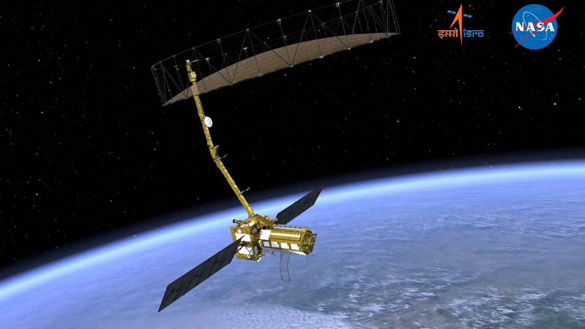
NISAR (NASA-ISRO Synthetic Aperture Radar) aims to monitor Earth’s surface using advanced radar imaging. A three-dimensional view of Earth will be generated through the two radars of NISARthat will be able to track changes in the surface with accuracy of a fraction of an inch. This project, which cost around $1.4 billion, is more than just a testament of collaboration between NASA and ISRO but a scientific marvel in itself. NISAR is the most advanced radar system that will generate around 80 terabytes of data per day. That is equivalent to one hundred and fifty hard drives that can store 512 GB. This is the maximum amount of data that will be generated per day by any Earth satellite that has ever been launched by NASA or ISRO. TheS-Band Radar of NISAR was developed by ISRO’s center in Ahmedabad, and the L-Band Radar was produced by NASA in Southern California. The labelling “L and S Band” is attributed to the microwave bandwidth regions from which the radar will collect the data.
How will this data from NISAR change things for scientists?
NISAR will map changes on the surface of Earth.Broadly, the applications can be seen in natural hazard monitoring, assessment of sea, ice, and glaciers, and also in crop management. The satellite will be able to see through clouds, rain, and in both day and night. The data will be able to provide insights into the time of glacial melting and provide unprecedented coverage ofAntarctica. Moreover, through NISAR, it will be possible to identify the parts of fault lines that move slowly and detect land movement essential for understanding and detecting earthquakes. Earthquakes have damaged large dams, like Koyna in 1967 and Shih-Gang in 1999, due to shaking or fault movement. NISAR satellite data can help prevent such failures by mapping ground shifts and fault risks with high precision.
The satellite will be used for ecosystem monitoring for land and ice-covered surfaces twice every twelve days and will also include parts of Earth that were not monitored so rigorously and with such frequency in the past. From forest canopies to croplands and from ice melts to land movements, NISAR will cover everything. Such detailed monitoring with advanced radar systems will thus paint a fresh picture of the planet in front of scientists. The data collected by NISAR is open access and is expected to unravel details of land movement and of ecosystems that may provide novel insights.From scientists to policymakers, this data will revolutionize our understanding of the planet.
Space Diplomacy and India’s new chapter in space
The NISAR project is critical to the US and India’s pioneering year of civil space cooperation. It was only in February 2025 when PM Modi visited the US and met President Donald Trump; the leaders hailed 2025 as a pioneering year for the U.S.-India civil space cooperation. The cooperation saw a bright beginning with the AXIOM Mission where Indian astronaut Shubhanshu Shukla traveled to space in a collaborative mission with NASA, making him only the second after Rakesh Sharma after a gap of almost four decades. It is clear that India is scripting a new chapter in space diplomacy, and it is not restricted only to the USA. ISRO has ongoing collaborative missions with other countries like France,Japan, Australia, Russia, Italy, and Europe. Given the success rate of ISRO, it has also become a key player in foreign launches with 433 foreign satellite launches from 34 countries. ISRO is pioneering space diplomacy through strategic international collaborations, fostering global cooperation and scientific advancement. By sharing expertise, resources, and satellite data, ISRO enhances global space research, promotes peaceful exploration, and positions India as a leader in space diplomacy.
Radar, Real-Time, and Responsibility
The NISAR mission marks a monumental leap in Earth observation, uniting ISRO and NASA in a shared vision to unravel our planet’s dynamic processes. By delivering unprecedented radar data, NISAR will empower scientists and policymakers to tackle climate change, natural disasters, and sustainable resource management with newfound precision. Beyond its scientific impact, the mission underscores India’s growing stature in space diplomacy, forging global partnerships that advance peaceful exploration and collective knowledge. As ISRO continues to collaborate with nations like the U.S., France, and Japan, NISAR stands as a beacon of innovation, cooperation, and India’s leadership in shaping the future of space exploration.
(Pooja Mishra is a Content Researcher at DD India)