A low-pressure system has formed over the west-central and northwest Bay of Bengal, close to the northern Andhra Pradesh and southern Odisha coasts, prompting the India Meteorological Department (IMD) to issue cyclone warnings for several Tamil Nadu ports.
According to the IMD, the system is expected to move in a west-northwest direction over the next few days.
As a result, heavy rainfall is likely along the coastal regions of Andhra Pradesh and Odisha, while Tamil Nadu, particularly its northeastern districts, is expected to experience intermittent showers influenced by the weather disturbance.
In view of the situation, cyclone warning signal number 1 has been hoisted at Nagapattinam port. Similar alerts have been sounded in eight other ports – Chennai, Cuddalore, Puducherry, Karaikal, Ennore, Pamban, Kattupalli, and Thoothukudi.
Signal 1, used in cyclone warning systems, indicates a low pressure area forming far out at sea with surface winds potentially reaching 33 knots (approximately 60 kmph). This signal acts as a preliminary warning, suggesting the potential development of a cyclone, but the port itself is not yet affected. It essentially signifies that the weather conditions at sea are starting to show signs of a cyclonic disturbance.
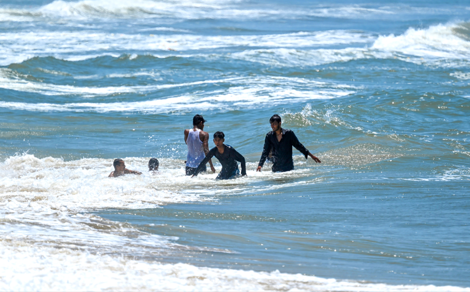
The warning indicates the possibility of squally winds and rough sea conditions, and fishermen have been strongly advised not to venture into the sea until further notice.
Weather officials have cautioned that while Tamil Nadu is not directly in the path of the low-pressure system, its coastal regions will still be affected.
“The system is more concentrated towards northern Andhra and southern Odisha, but Tamil Nadu’s northeastern belt will see spells of rain over the coming days,” the IMD said.
Authorities have already begun implementing precautionary measures at ports, while district administrations in coastal regions have been alerted to prepare for heavy rains, possible waterlogging, and gusty winds.
Emergency response teams have also been instructed to remain on standby.
The IMD added that it is closely tracking the development and movement of the system, and further updates will be issued depending on its intensification.
Residents in coastal areas have been urged to follow weather advisories and cooperate with safety instructions.
The low-pressure system comes at a time when the southwest monsoon is active across Tamil Nadu.
Meteorologists said the combination of monsoon activity and the Bay of Bengal disturbance could bring additional rainfall, providing relief from heat but also increasing the risk of local flooding in low-lying areas.
Meanwhile, continuous heavy rainfall in the Cauvery catchment areas of Karnataka and Kerala has pushed the Kabini and Krishnaraja Sagar (KRS) reservoirs to their full capacity, forcing authorities to release large volumes of water downstream.
This has resulted in a dramatic rise in the flow of the Cauvery River, leaving Hogenakkal in Tamil Nadu’s Dharmapuri district inundated and prompting flood alerts for residents along the riverbanks.
Officials confirmed that both reservoirs in Karnataka had reached their maximum storage levels and began releasing water as a precautionary measure.
The sudden and heavy inflow has transformed the Hogenakkal landscape, with the riverbanks overflowing and low-lying areas resembling flooded forests.
The Dharmapuri district administration has responded with precautionary measures, banning bathing and coracle rides in the Hogenakkal tourist zone to ensure public safety.
Residents living in vulnerable areas along the Cauvery have been advised to move to safer locations until the situation stabilises.
Officials in both Karnataka and Tamil Nadu are closely monitoring the situation. While Karnataka authorities continue to regulate releases from Kabini and KRS based on rainfall patterns, Tamil Nadu’s water resources and disaster management teams remain on high alert.
Evacuation measures are in place should the river level rise further.
(IANS)