





Key takeaways:
-
ISRO successfully launched navigation satellite NVS-03 aboard GSLV-F18 on October 30, 2026, to strengthen India’s NavIC system.
-
NVS-03 carries navigation payloads in the L1, L5 and S frequency bands, along with an indigenously developed atomic clock.
-
NavIC provides positioning, navigation and timing services for civilian and authorised strategic users across India and a region extending approximately 1,500 km beyond its geopolitical boundary.
India has taken another step towards strengthening its indigenous satellite navigation capabilities with the successful launch of NVS-03, the third satellite in the next-generation Navigation with Indian Constellation (NavIC) series.
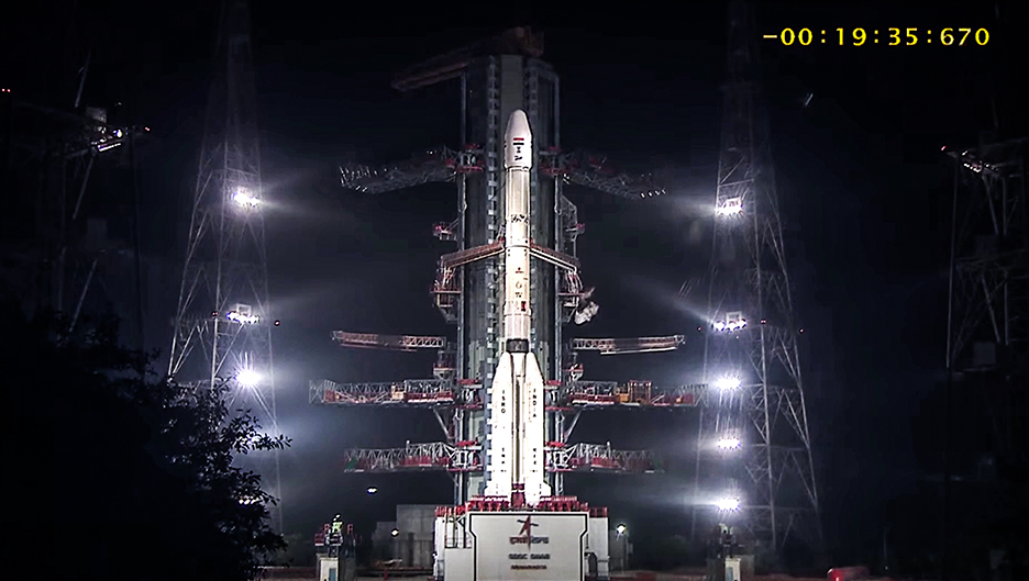
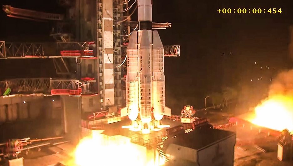
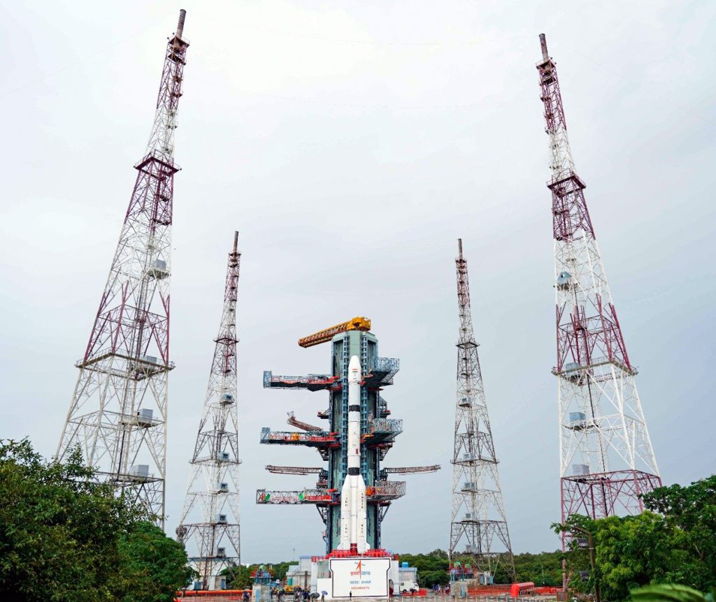
The Indian Space Research Organisation (ISRO) launched the navigation satellite aboard the Geosynchronous Satellite Launch Vehicle (GSLV-F18) from the Satish Dhawan Space Centre in Sriharikota on October 30, 2026, at 11:51 PM.
The mission is aimed at improving the coverage, accuracy and reliability of NavIC, India’s regional satellite navigation system. It also strengthens the country’s ability to provide independent Positioning, Navigation and Timing (PNT) services for civilian, commercial and strategic applications.
What is NVS-03 and why is it important?
NVS-03 is the third satellite in ISRO’s second-generation navigation satellite series, comprising five satellites from NVS-01 to NVS-05. The series is being developed to augment the existing NavIC constellation and ensure continuity of indigenous navigation services.
The GSLV-F18 placed NVS-03 into a Geosynchronous Transfer Orbit (GTO). Its first orbit-raising manoeuvre was completed on October 31, while further manoeuvres are planned to place the satellite in its designated geosynchronous orbital slot at 111.75 degrees East.
The satellite, weighing approximately 2,250 kilograms, carries navigation payloads in three frequency bands — L1, L5 and S. The addition of the L1 signal alongside the L5 and S bands is intended to enhance NavIC’s capabilities and compatibility with navigation receivers.
NVS-03 also carries an indigenously developed atomic clock alongside procured atomic clocks. These clocks provide highly precise time references required to generate navigation signals and determine users’ positions accurately.
What is NavIC?
Navigation with Indian Constellation, or NavIC, is India’s regional satellite navigation system developed by ISRO. It was earlier known as the Indian Regional Navigation Satellite System (IRNSS).
The system provides Positioning, Navigation and Timing services to users. It was originally designed around a seven-satellite constellation, supported by a network of ground stations operating round the clock. Its architecture comprises three satellites in geostationary orbit and four in inclined geosynchronous orbit.
NavIC provides coverage over the Indian landmass and a region extending approximately 1,500 kilometres beyond India’s geopolitical boundary.
The system is designed to support applications such as road and maritime navigation, aircraft tracking, precision agriculture, disaster management and telecommunications.
How does a satellite navigation system work?
A satellite navigation system uses a network of satellites that continuously transmit signals containing information about their position and precise timing.
Receivers on Earth, including those in smartphones, vehicles and navigation equipment, collect signals from multiple satellites. By calculating the time taken for these signals to reach them, receivers determine their location, speed and direction.
Accurate timing is central to this process. Even small errors in signal timing can affect the accuracy of position calculations. This is why atomic clocks are an important component of navigation satellites.
What are the L1, L5 and S frequency bands?
Navigation satellites transmit radio-frequency signals through designated frequency bands. NVS-03 carries payloads in the L1, L5 and S bands.
The use of multiple frequency bands gives compatible receivers access to signals transmitted at different frequencies. It also allows receiver systems to be designed for different applications and operating conditions.
The addition of the L1 signal to the existing L5 and S signals in the next-generation NavIC satellites is intended to improve the system’s capabilities and compatibility.
What services does NavIC provide?
NavIC offers two types of navigation services:
Standard Positioning Service (SPS): An open service available to civilian users. Its signals are interoperable with signals from other global navigation satellite systems, including GPS of the United States, GLONASS of Russia, Galileo of the European Union and BeiDou of China.
Restricted Service (RS): An encrypted service available exclusively to authorised strategic users.
These services allow NavIC to cater to both civilian requirements and strategic applications.
What is a Geosynchronous Transfer Orbit?
After launch, a satellite intended for a geosynchronous or geostationary orbit is generally first placed in an elliptical Geosynchronous Transfer Orbit.
This orbit has a low perigee, or the point closest to Earth, and a high apogee, or the point farthest from Earth. Near apogee, the satellite uses its onboard propulsion system to raise its perigee and gradually circularise its orbit.
In the case of NVS-03, the orbit-raising manoeuvre is being performed using a Liquid Apogee Motor (LAM), a chemical rocket engine. Additional manoeuvres help position the satellite in its designated orbital slot.
What role does GSLV play in the mission?
The Geosynchronous Satellite Launch Vehicle is a three-stage launch vehicle developed by ISRO to place satellites into Geosynchronous Transfer Orbit and Low Earth Orbit.
GSLV’s indigenous cryogenic upper stage is a key feature of the launch vehicle. It uses liquid hydrogen as fuel and liquid oxygen as oxidiser, both stored at extremely low temperatures. The development of this technology replaced the Russian-supplied stage used in earlier GSLV flights and strengthened India’s self-reliance in advanced launch vehicle technology.
The GSLV-F18 mission marked the 20th flight of India’s GSLV. The vehicle stands approximately 50 metres tall and has a lift-off mass of around 420 tonnes.
Progress of India’s next-generation NavIC satellites
The five-satellite NVS series is intended to strengthen the existing NavIC constellation and ensure continuity of navigation services.
NVS-01, the first satellite in the series, was launched on May 29, 2023, aboard GSLV-F12. It carries L1, L5 and S band navigation payloads and an indigenously developed Rubidium atomic clock.
NVS-02 was launched on January 29, 2025, aboard GSLV-F15. However, its orbit-raising manoeuvre could not be carried out because the oxidiser valves did not open, preventing the satellite from reaching its intended orbital slot.
With the launch of NVS-03, three satellites in the second-generation series have been launched. NVS-04 and NVS-05 are the remaining satellites planned under the programme.
Strengthening India’s space sovereignty
The NVS series is part of India’s efforts to strengthen its independent navigation infrastructure and reduce dependence on foreign satellite navigation systems for critical applications.
By improving NavIC’s coverage, reliability and availability, ISRO aims to support a wide range of civilian, industrial and strategic services.
-PIB


